

I can’t believe it! The Japanese Government has done something agreeable!!
Can we export the same data to Subnautica? Asking for a friend
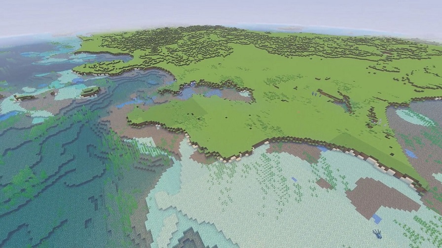
topographic
Technically, elevation data of the waterbed of a water body is called bathymetry.
Still such a cool project though
Phenomenal use of Minecraft, as this kind of information is easier to process if you can interact with it.
Yeah I love seeing governments and researchers do stuff like this. Years ago a country released a 1to1 scale map of their whole country, denmark I think.
I remember reading about the Denmark 1 to 1 map, that was pretty badass…Given that Denmark is so small, it was an easy ask to make a Minecraft map!
It would have been great if it was released for luanti, an opensource clone.
Minecraft is a paid game controlled by Microslop and isn’t accessible to all freely.
You have to remember that most know about Minecraft more readily than Luanti, so…It makes sense that Minecraft was chosen for this specific map. Hell, general people are more likely to know about Minecraft vs Luanti, so if we want more maps in open source projects…We need to make sure that Luanti becomes a household name like Minecraft to get that treatment.
will I get to have intercourse with slimy hentai octopus monsters once I reach the bottom of the pit

I’m sure some modder can arrage for that
woah :O
Lately, when I read the news, I occasionally get this urge to go build a house at the bottom of the Mariana Trench and just live there. Now I have a straightforward way to scout out a good location.
I’d say I should go to any old pole of inaccessibility, but I have this sneaking suspicion that whenever I showed up at Point Nemo, for example, I’d find a crowd of people there.
The Yonaguni Monument